
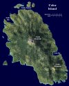
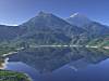
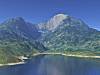
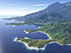
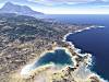
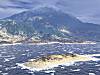
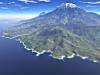
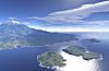
Color Island was one of the refugees' first landing places and is the location of one of Oedloor's more isolated populations. Its name derives from the impression the first settlers had of the island upon seeing it in full bloom in the spring. It is part of an archipelago that divides the Sea of Gratitude to the west and the Ocean to the east. It consists of of an older, extinct and heavily eroded volcano in the south and a younger, dormant volcano in the north. Unlike the Prawahalla Valley landscapes, these landscapes depict the island in its pristine state, prior to settlement and cultivation. I have not yet named its geographical features and have just used the points of the compass as working names.
Click on the thumbnails for larger images.
 |
 |
 |
 |
 |
|
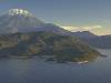
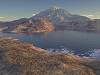
| Map of Color Island | First View | North End Sunset | Dry Season Sunset | East Bay, North Shore | East Bay, South Shore |
 |
 |
 |
 |
 |
 |
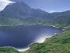
| South Bay | South End | The Lagoons | Blustery Day | East Coast | North Channel |